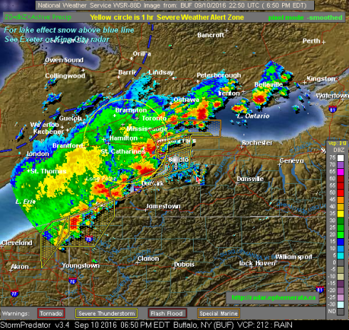
SEVERE WEATHER ALERT — 07:08 PM EDT Sep 10 2016
This is an automated alert of potentially severe weather for the Golden Horseshoe/ Greater Toronto/Niagara Peninsula/South-Central Ontario Monitored Area, from Ephemerata Weather Radar. See attached scan image.
The alert triggered at 07:08 PM EDT on Sep 10 2016, from radar data analyzed
from NWS radar site KBUF in Buffalo, NY, operating in Short Range Composite Reflectivity (NCR), VCP mode 212.
This alert was issued because radar echo returns exceeding 55 dbZ have been detected in the alert zone. The maximum detected radar echo level in this alert
was equal to or greater than: 60 dbZ. These values are an indication of potentially severe weather occurring or developing within the alert scan zone:
*** “4” to 8″/hr very heavy rain: marble size hail possible” ***
and may include extremely strong storm related winds and tornadic activity. Go to http://weather.gc.ca/warnings/?prov=son for official weather reports and to assess your personal risk.


Leave a comment
Comments feed for this article